Protect A Coastline
Give vulnerable communities the data they need to fight erosion and save their shores

Your Sponsorship Puts Science In Their Hands
When you sponsor a community, you give them access to the same high-resolution data that guides decisions in the world's most advanced coastal programs. They get maps, performance scores, and predictions—the tools to understand what's happening to their shore and which solutions actually work.

Your Support Helps Communities
%201.avif)
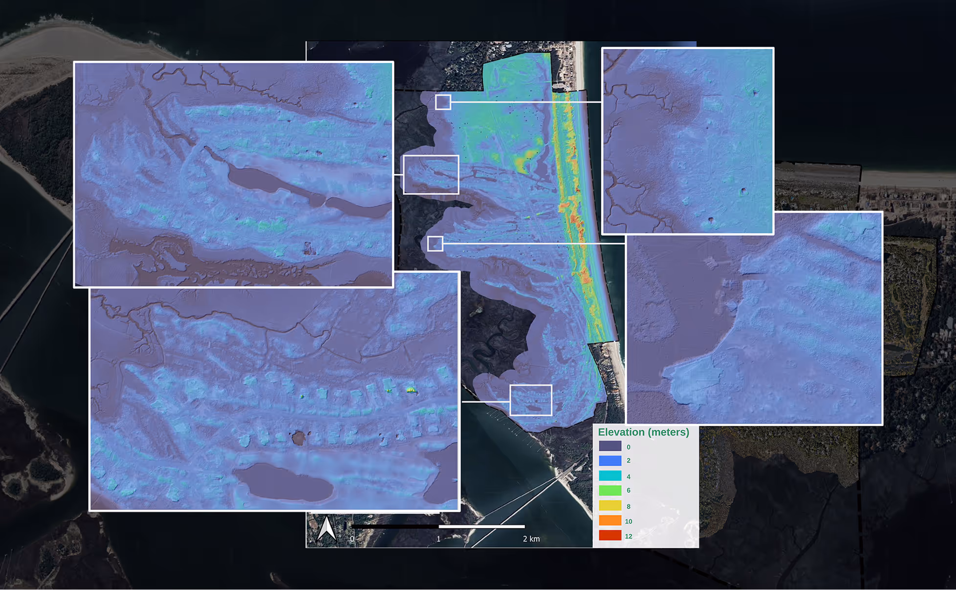
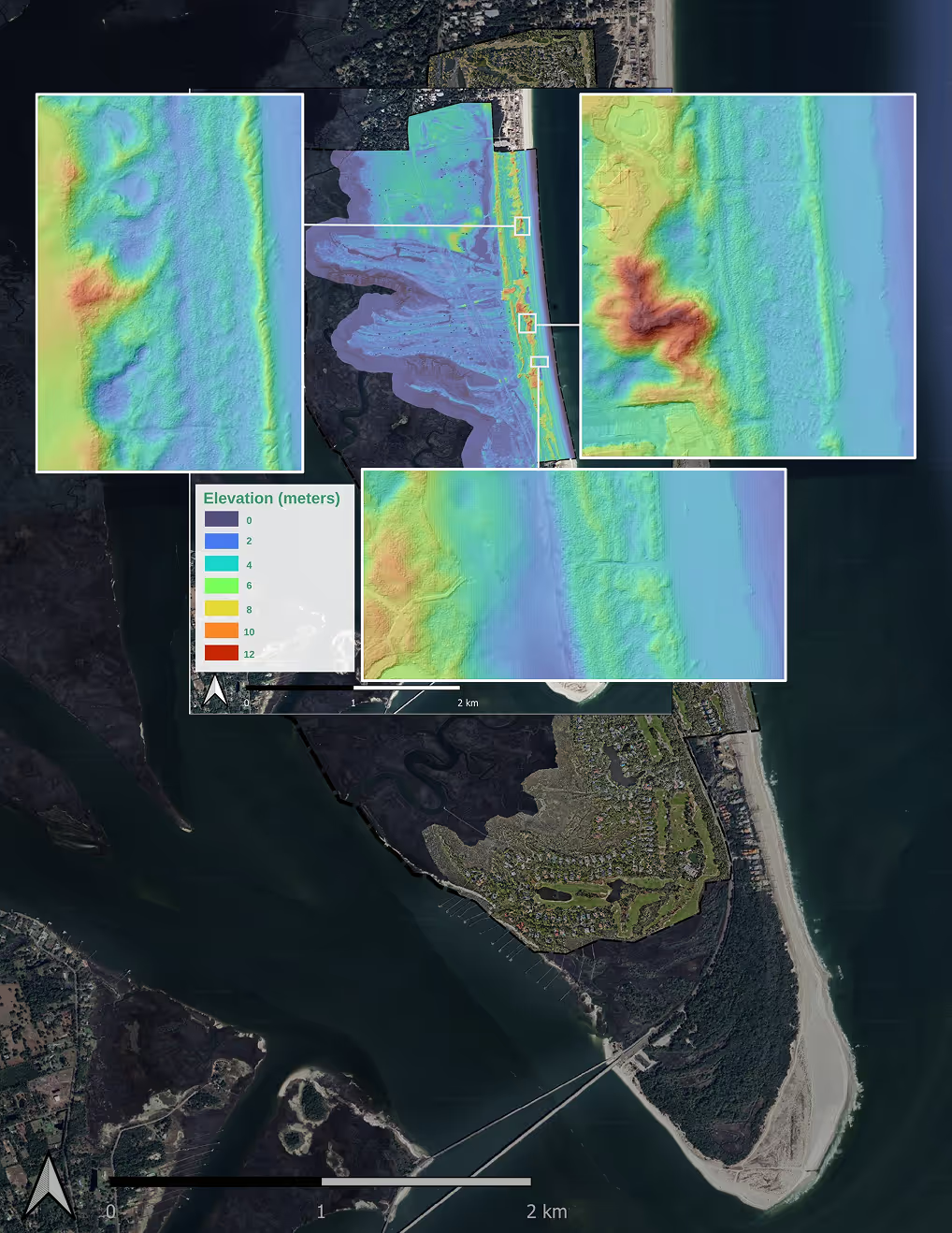
High-Resolution Data Collected Year-Round
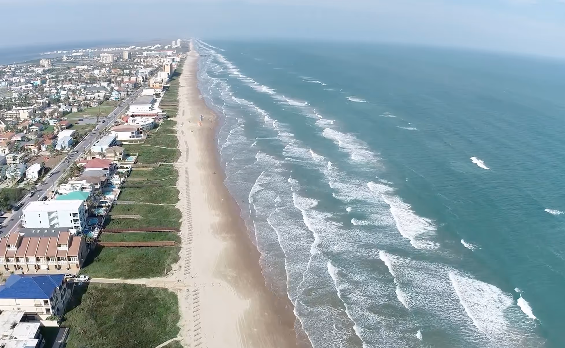
Drones and aircraft capture every shift in the shoreline
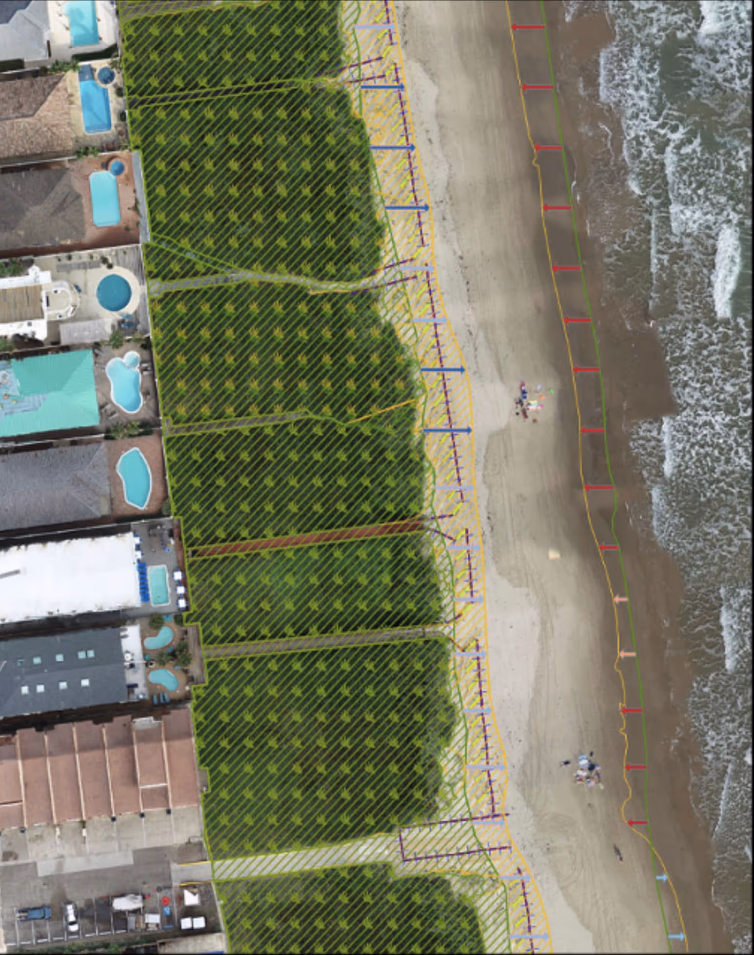
Reports That Guide Real Decisions
Coastal managers get actionable intelligence, not raw data
Improved Mitigation ROI For Communities
By knowing what works communities can invest in solutions that work long term
Sponsorship Creates Measurable Change
Communities backed by sponsors see their shorelines clearly and make decisions with confidence. The data speaks for itself.
Communities Served
Acres Monitored
Drone Scans Completed

.avif)
See How RCOAST Helps Communities
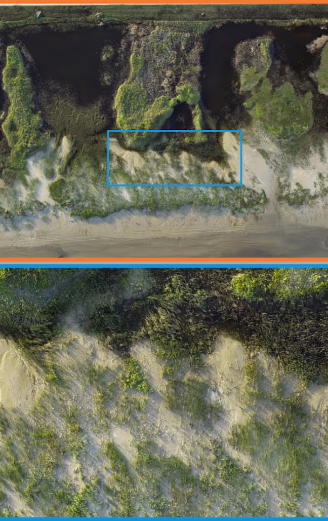
Aerial platforms capture real-time coastal conditions across documented projects, artificial intelligence analyzes data from specific scenarios, and you gain the knowledge to respond to similar situations.
Sponsor a community today
Choose your commitment level and help a shoreline that needs it
Questions
Everything you need to know about supporting a coastal community
You choose a commitment level and we match you with a community that needs monitoring. Your support funds the data collection, analysis, and tools that coastal managers use to make decisions. It's direct, transparent, and measurable.
We work with vulnerable coastlines across the globe. You can sponsor an existing community in our network or help us expand to a new shoreline. Each community has different needs and timelines, so we'll help you find the right fit.
Monitoring begins immediately. You'll receive regular reports showing what the data reveals about coastal change and how interventions are performing. You're part of the process from start to finish.
Sponsorships typically run one to three years, depending on your preference and the community's needs. We can discuss flexible terms that work for your timeline and budget.
Yes. We share case studies and data from communities we're already monitoring. You'll see exactly what the work looks like and what kind of insights communities gain from the data.
Every dollar goes to data collection, processing, and delivery. We break down costs clearly so you know exactly what your sponsorship funds—from drone flights to analysis to the tools coastal managers use.
You receive all reports and insights generated for the community you sponsor. You can see the maps, performance scores, and predictions that guide their decisions. Transparency is built into everything we do.
Coastal work is unpredictable. If priorities shift or new threats emerge, we adjust the monitoring plan and keep you informed. Your sponsorship remains focused on what matters most to that community.
Absolutely. Some communities benefit from several sponsors, each supporting different aspects of the work. We coordinate everything so the data collection stays seamless and comprehensive.
Success means the community has the data they need to make better decisions and measure whether their solutions work. We track coastal change over time and report on decision-making improvements and intervention outcomes.
Need more answers?
Reach out and we'll walk you through the details