2025 AIPCA Natural Resources Inventory
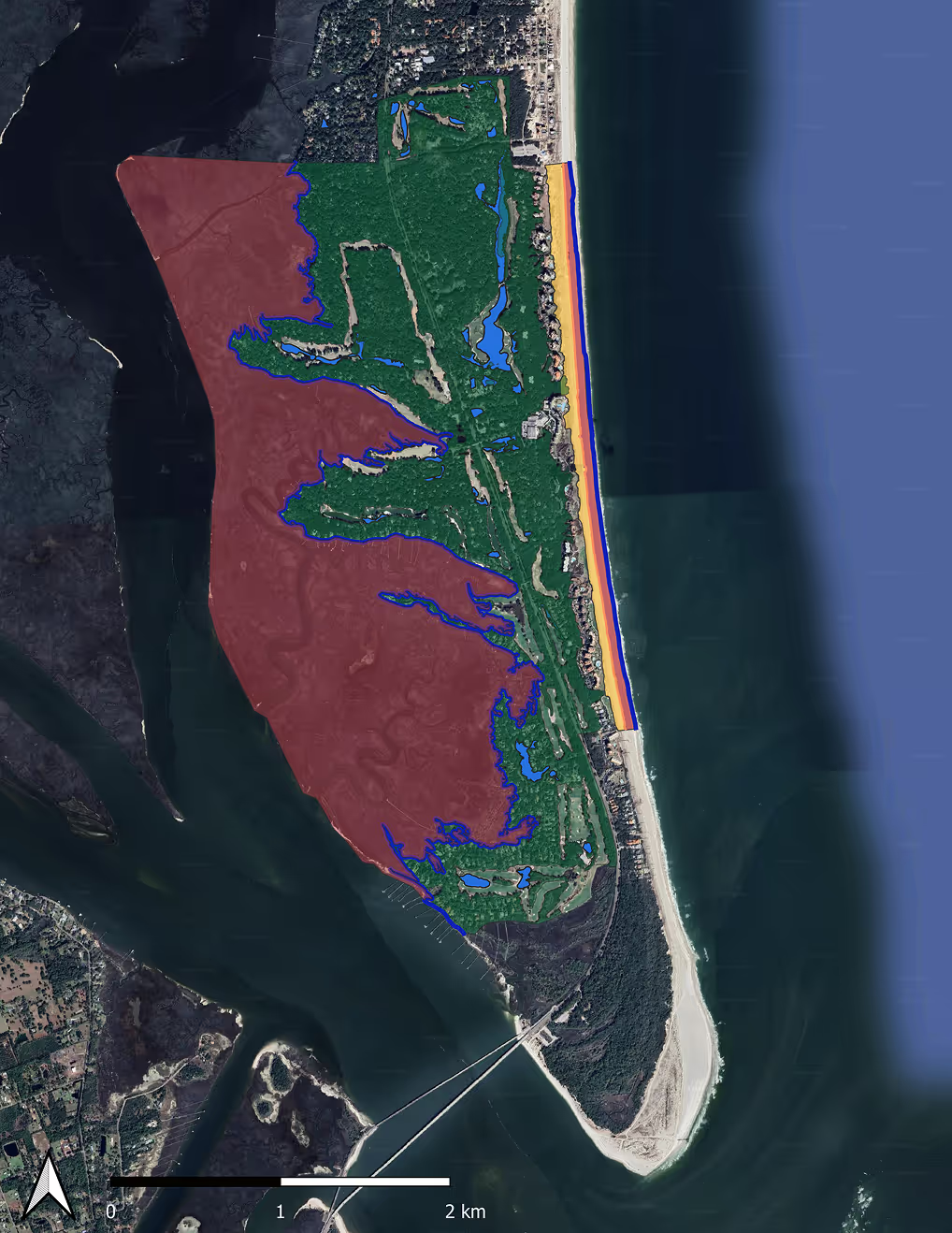
Drone-based LiDAR and imagery were used to create a detailed baseline of Amelia Island’s beaches, dunes, marshes, and forests amid accelerating climate-driven change. The resulting maps, elevation models, and GIS tools give local decision-makers a clear view of current vulnerabilities and a foundation for monitoring change, guiding management actions, and strengthening long-term coastal resilience.
About The Project
This report delivered AIPCA a clear, actionable understanding of current coastal and natural resource conditions by establishing a high-resolution, drone-based baseline of beaches, dunes, marshes, forests, and flooding vulnerabilities. By integrating LiDAR, imagery, and NOAA and FEMA data, the analysis identified priority risk areas and translated complex environmental change into practical insights AIPCA can use to guide mitigation, resilience planning, and resource protection.
Equally important, the report provided AIPCA with easy-to-use GIS and 3D visualization tools, enabling leadership to access, update, and apply the data over time. These outcomes support smarter decision-making, more targeted investments, and ongoing monitoring—helping AIPCA reduce risk, plan proactively, and manage Amelia Island’s natural resources with confidence as coastal conditions evolve.
Key Takaways
Outcomes of the 2025 AIPCA Natural Resources Inventory
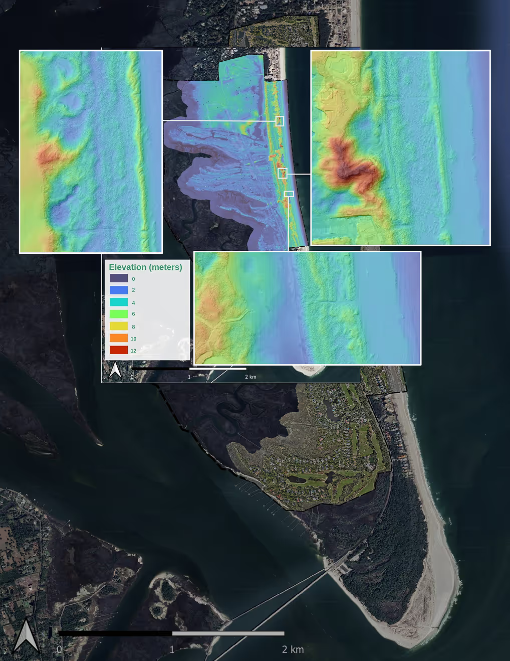
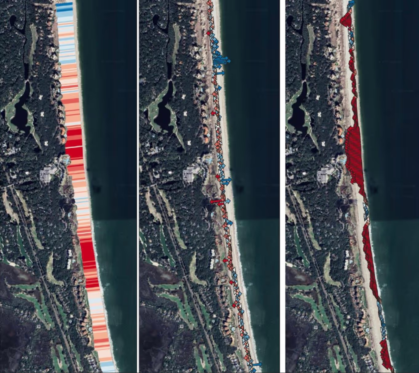
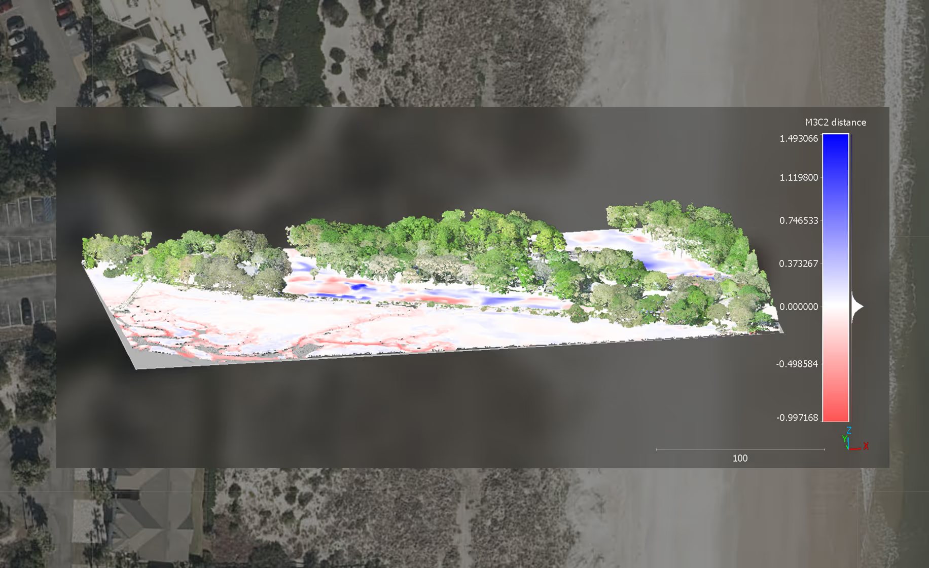
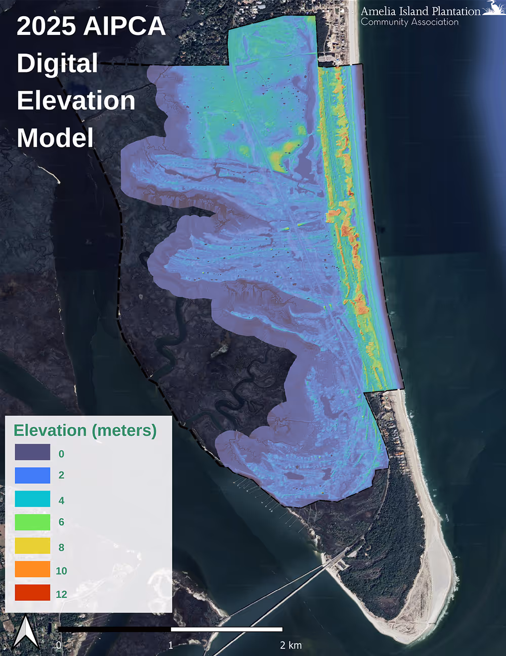
Established a defensible coastal baseline
High-resolution LiDAR and imagery created a clear, measurable snapshot of current conditions to track erosion, flooding, and habitat change over time.
Turned data into decisions
Interactive GIS and 3D tools gave AIPCA leadership direct access to insights that support risk reduction, targeted mitigation, and long-term planning.

Ready to protect your coastline today?
Join communities worldwide using RCOAST to monitor and measure what works.