NSF RAPID for Boston College
RCOAST partnered with Boston College, U. Mass, and the Water Institute to quantify coastal geomorphic changes on Matagorda and Follet’s Islands following Tropical Storm Alberto and Hurricane Beryl. Using drone-based LiDAR, RGB imagery, and pre-storm photogrammetry, RCOAST mapped beaches, dunes, and outwash channels, created high-resolution DEMs, and calculated volumetric changes. The analysis provided a clear, data-driven understanding of storm impacts, enabling researchers and managers to assess vulnerability, guide restoration planning, and inform future storm resilience strategies.
About The Project
The project was completed in two phases.
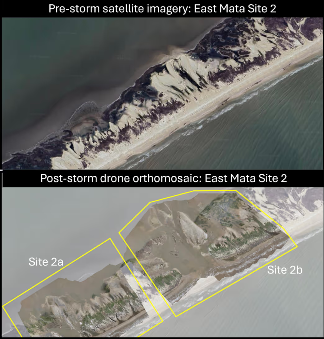
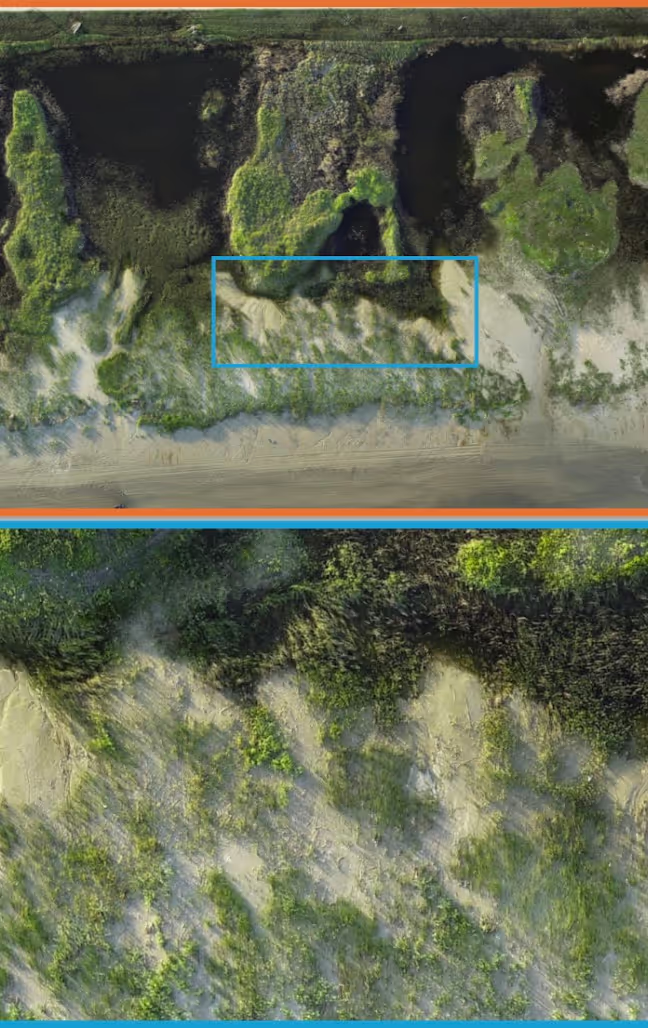
- Phase 1 involved drone surveys at three field sites to capture post-storm beach, dune, and outwash channel conditions using a Matrice 300 RTK with Zenmuse L1.
- Phase 2 focused on analysis, including cleaning and aligning drone-based data with pre-storm LiDAR, generating DEMs at multiple resolutions, and conducting volumetric calculations.
This approach quantified topographic and geomorphic changes caused by Tropical Storm Alberto and Hurricane Beryl, providing actionable insights into coastal erosion, sediment redistribution, and vulnerability hotspots.
The dataset supports ongoing monitoring and informs both research and practical coastal management decisions.
Key Takaways
Outcomes of the NSF RAPID for Boston College project
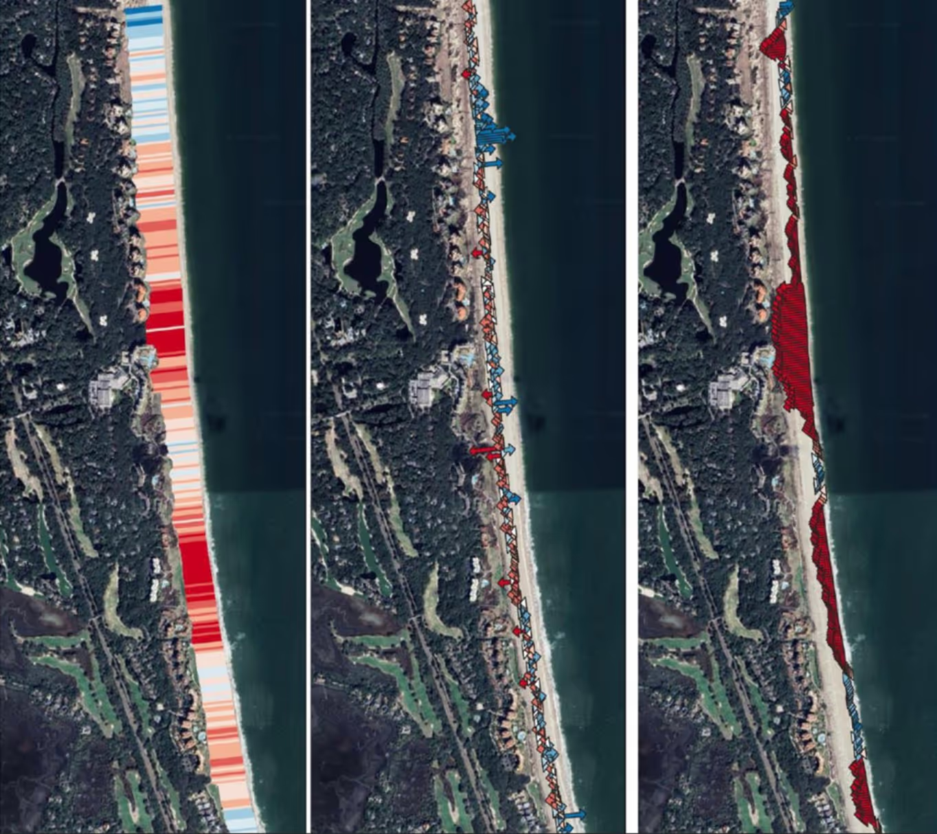
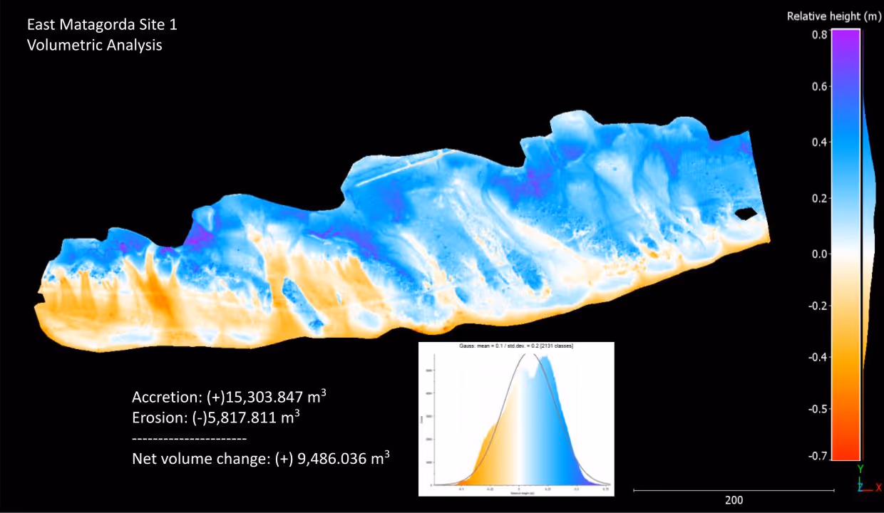
Quantified storm impacts with precision
Volumetric analyses of beaches, dunes, and outwash channels revealed specific geomorphic changes from Tropical Storm Alberto and Hurricane Beryl.
%201%20(2).avif)
Data-driven planning enabled
High-resolution DEMs and change detection provide critical insights for restoration, risk assessment, and future storm resilience strategies.

Ready to protect your coastline today?
Join communities worldwide using RCOAST to monitor and measure what works.