South Padre Beach: Tracking Coastal Change in 3D
RCOAST delivered a high-resolution, drone-based 3D baseline of South Padre Beach to support a proposed dune re-planting project. Using LiDAR and RGB imagery, the survey captured detailed topography of the shoreline, beach, and dunes, producing actionable datasets that allow Coastal Transplants to understand current conditions, quantify recent change, and plan restoration efforts with confidence.
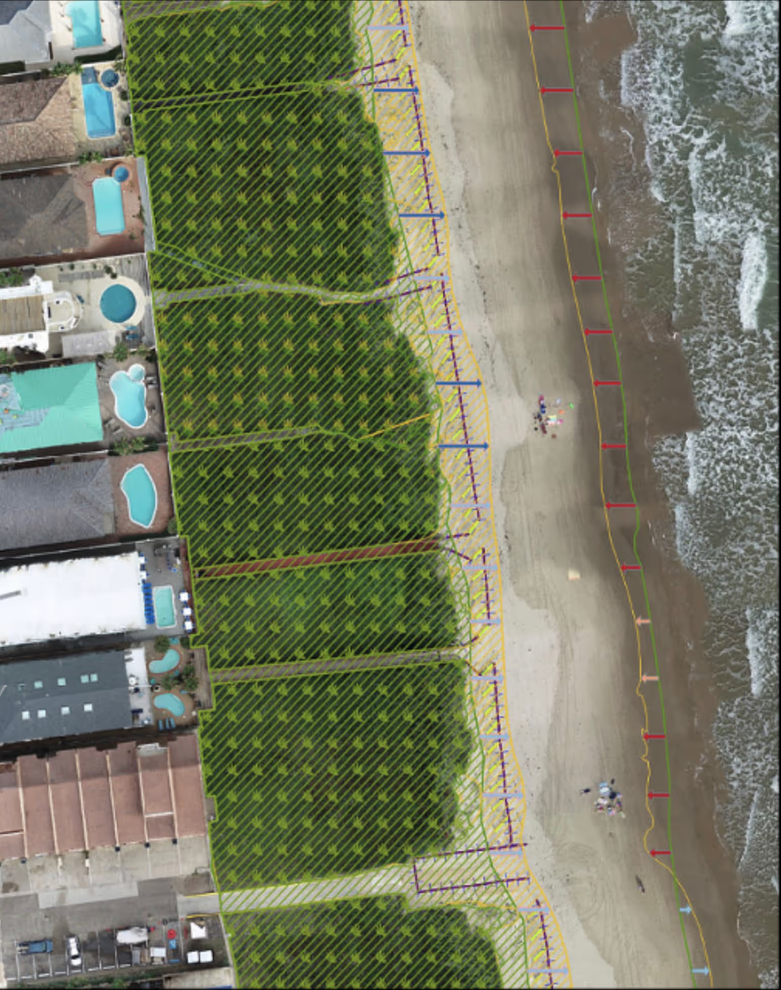
About The Project
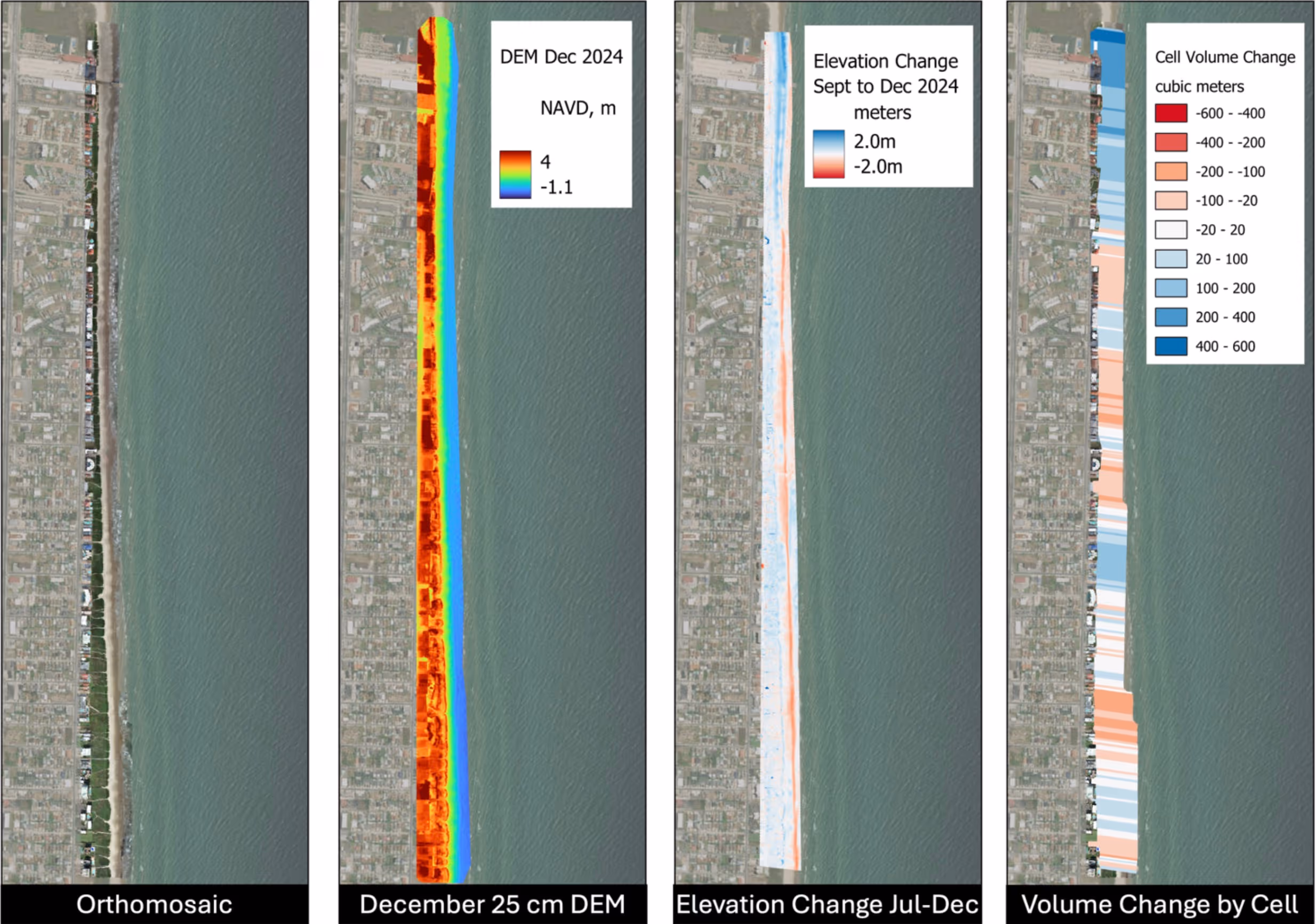
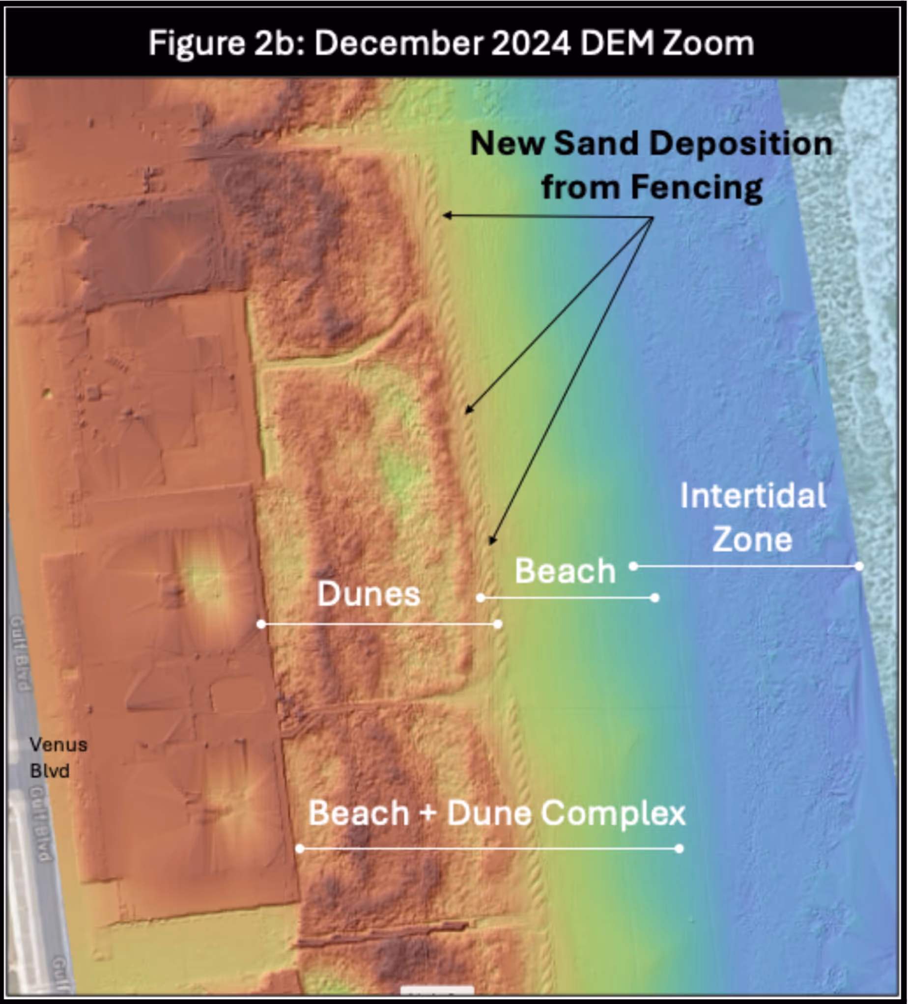
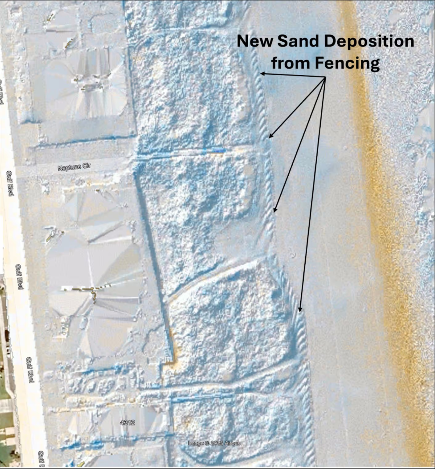
RCOAST conducted a comprehensive LiDAR and RGB drone survey of South Padre Beach in December 2024 using a DJI Matrice 300 RTK with a Zenmuse L1 payload. The collected point cloud and imagery data were processed into a suite of decision-ready deliverables, including a baseline digital elevation model, volumetric and areal change detection, high-resolution orthomosaics, and interactive 3D models.
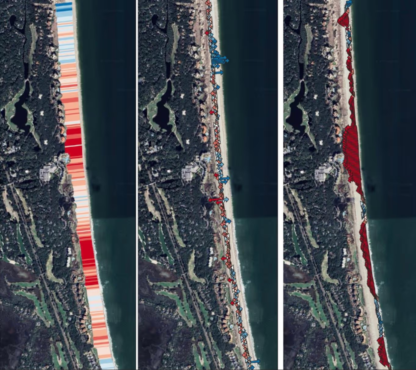
Additional analyses compared the new data against earlier surveys and publicly available LiDAR, providing Coastal Transplants with clear insight into erosion trends and dune dynamics.
Together, these outputs establish a defensible baseline and practical tools to guide dune restoration design, monitoring, and long-term coastal management.
Key Takaways
Outcomes of the South Padre Beach project
Restoration-ready baseline created
High-resolution LiDAR and imagery provide a precise foundation for dune re-planting design and future performance monitoring.
Change quantified, not assumed
Volumetric and comparative analyses reveal where erosion and deposition are occurring, reducing uncertainty in restoration planning.

Ready to protect your coastline today?
Join communities worldwide using RCOAST to monitor and measure what works.