How a coastal town saved its
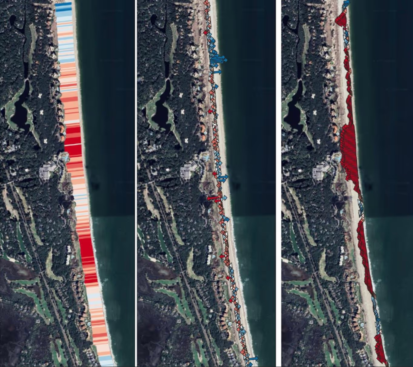
The shore was dying. That much was clear from the first flight. RCOAST sent a drone equipped with LiDAR and multispectral imaging across the Louisiana coastline, capturing data at a resolution that left nothing hidden. Every meter of erosion. Every pattern of retreat. The machines saw what human eyes could only guess at.

About The Project
The shore was dying. That much was clear from the first flight. RCOAST sent a drone equipped with LiDAR and multispectral imaging across the Louisiana coastline, capturing data at a resolution that left nothing hidden. Every meter of erosion. Every pattern of retreat. The machines saw what human eyes could only guess at.
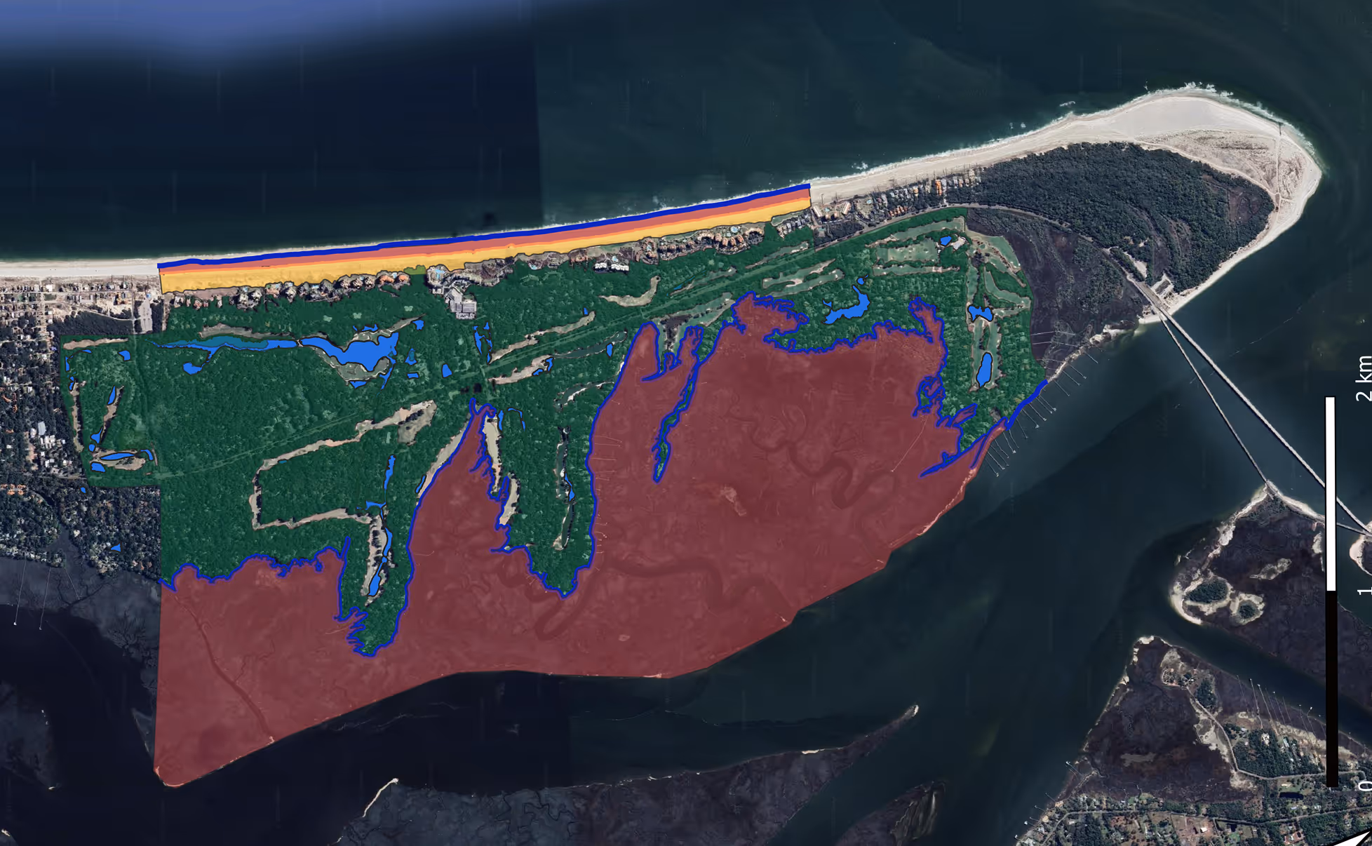
The community had known something was wrong. They'd watched the water creep inland year after year. But knowing and understanding are different things. The data gave them understanding. It showed exactly where the shoreline was failing, how fast it was moving, and what forces were driving the change. No theories. No estimates. Just the hard numbers.
The community had known something was wrong. They'd watched the water creep inland year after year. But knowing and understanding are different things. The data gave them understanding. It showed exactly where the shoreline was failing, how fast it was moving, and what forces were driving the change. No theories. No estimates. Just the hard numbers.

%201.avif)

Ready to protect your coastline today?
Join communities worldwide using RCOAST to monitor and measure what works.