How a coastal town saved its shore
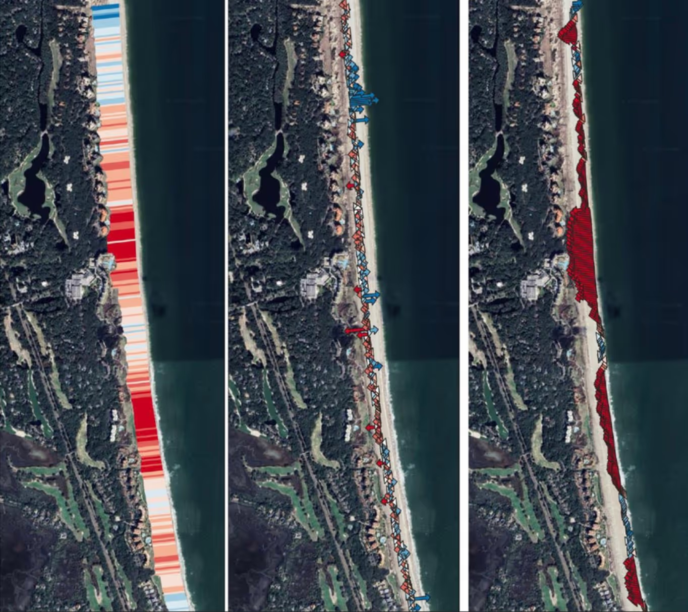
The shore was dying. That much was clear from the first flight. RCOAST sent a drone equipped with LiDAR and multispectral imaging across the Louisiana coastline, capturing data at a resolution that left nothing hidden. Every meter of erosion. Every pattern of retreat. The machines saw what human eyes could only guess at.

About The Project
The shore was dying. That much was clear from the first flight. RCOAST sent a drone equipped with LiDAR and multispectral imaging across the Louisiana coastline, capturing data at a resolution that left nothing hidden. Every meter of erosion. Every pattern of retreat. The machines saw what human eyes could only guess at.
The community had known something was wrong. They'd watched the water creep inland year after year. But knowing and understanding are different things. The data gave them understanding. It showed exactly where the shoreline was failing, how fast it was moving, and what forces were driving the change. No theories. No estimates. Just the hard numbers.
The community had known something was wrong. They'd watched the water creep inland year after year. But knowing and understanding are different things. The data gave them understanding. It showed exactly where the shoreline was failing, how fast it was moving, and what forces were driving the change. No theories. No estimates. Just the hard numbers.

%201.avif)

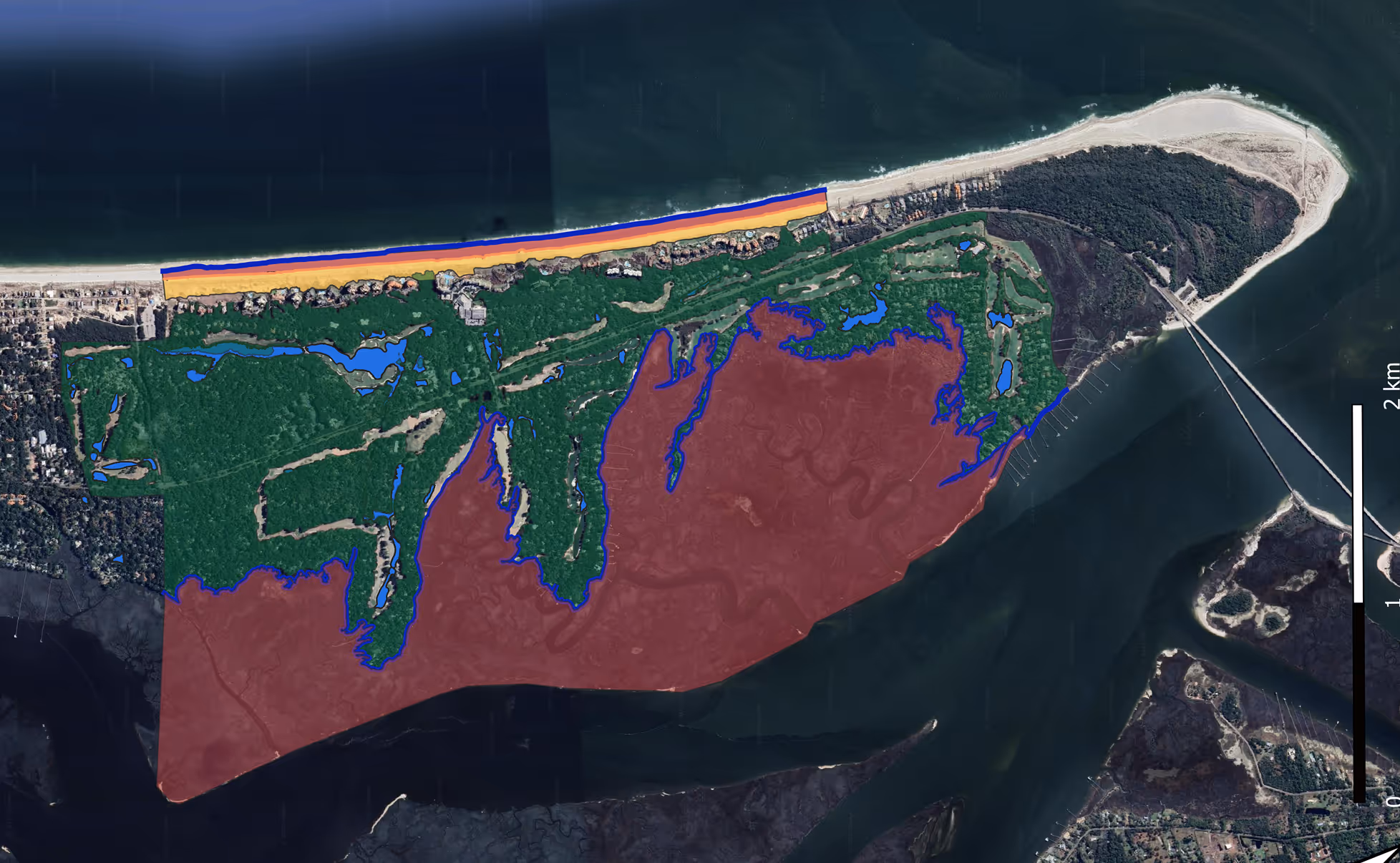
Taking A Look At The Data
This case shows what becomes possible when communities have access to real data. The metrics below tell the story of a shoreline saved and a model that works.
Erosion rate reduction
Retreat halted and stabilization achieved in monitored zones
Cost per meter saved
Living shoreline proved far more economical than traditional bulkheads
ROI within first year
Avoided future damage costs exceeded initial intervention investment
Communities now using this data
Global network learning from this single shoreline's success story
2023
Baseline assessment
LiDAR and multispectral imaging captured every meter of coastline. The numbers told the story.
2023
Intervention deployed
Living shoreline construction began. The community chose this path because data from similar projects showed it would work.
2024
Monitoring and measurement
Quarterly flights tracked every change. The data showed the shoreline stabilizing where it had been retreating.
2024
Results and lessons
The intervention worked. Now other communities use this data to make their own decisions.

Ready to protect your coastline today?
Join communities worldwide using RCOAST to monitor and measure what works.